

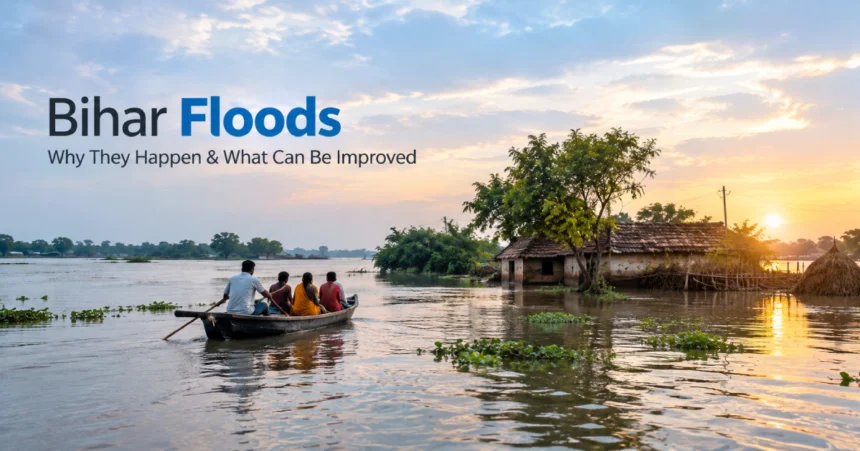
The Flood Story That Returns Every Year.
During each monsoon season, numerous families in Bihar keep a close eye on the river’s water levels.
Increased river rises signal the movement of livestock and other valuables to higher ground for some. For some, it means roads flooding and crops being destroyed, school closures, and days or weeks spent living in a home with water.
Floods are not an uncommon phenomenon in Bihar. However, with the problem recurring, there is a crucial question that needs to be addressed:
Why Bihar floods so many times and how to minimize the loss?
It’s not just “Too much rain”.
The geography, the river systems of Bihar, the rainfall in the catchments of the Himalayas, the sediment, embankments and land and water management are all related to the flood situation in Bihar. The Government of India and the Central Water Commission (CWC) reported that satellite data from 1986 to 2022 showed that Bihar had an estimated 29.14 lakh hectares of flood-affected area.
It is important to consider how these reasons can help you to think about what could be done differently.
Why Bihar is suffering from a lot of floods.
Most of the flood hazards of North Bihar are caused by river Kosi, Gandak, Bagmati, Kamla, Burhi Gandak and Mahananda.
1. Rivers Bring Huge Amounts of Water From the Himalayan Region
A number of these rivers are fed by flows from upper catchment areas which are primarily located in Nepal. In those areas, heavy rainfall may lead to a rise in the river discharge, and convey a high volume of water downstream in Bihar. Heavy rainfall in the upper catchments of the river is one area in North Bihar, which is a specific concern for the Government of India in the context of flooding.
It is not possible for Bihar to rely solely on the state level capacity building for flood preparedness.
Also, it needs joint action and sharing of information throughout the river basins with Nepal.
2. Bihar’s Flat Land Makes Drainage Difficult
Suppose that you put a bucket of water on a steep hill. The water runs rapidly downwards in most of the places.
Now imagine pouring the identical water on a large, nearly flat surface.
It will take a lot longer for them to leave.
The gradients in parts of Bihar, especially in the northern plains are very low. Rivers can over-top or excess rain can fall causing water to stay on the land for extended periods of time.
Bihar’s water security has been recently evaluated by the World Bank and the consequences of flooding are very severe in North Bihar due to various reasons such as increased monsoon rainfall, inflow from Nepal, level topography, and high sediment loads.
Therefore, it is possible that the issue doesn’t go away right away even after the rain has stopped.
3. Silt Makes the Problem More Complicated
There’s another facet to the tale that’s not always obvious—sediment.
The rivers in the Himalayas transport a considerable amount of sediment. In the planes the river slows down and some of the material settles.
Sediment has the potential to impact river channels, drainage systems and agricultural land over time.
High sediment loads were identified as one of the important characteristics of Bihar’s flood problem by the World Bank.
This makes it hard to break out of this cycle.
With heavy rain, more water is brought in. Rivers carry sediment. Sediment alters the flow and drainage of water. If water isn’t able to drain off rapidly, flooding can persist longer.
4. Embankments Help, But They Are Not the Complete Answer
Embankments are one of the important components of the flood management system in Bihar. They are intended to retain the flow of the river in a channel and safeguard settlements and farmlands.
However, what is not a magic wall is an embankment.
It must be continually monitored, maintained and properly designed. Houses may also suffer from pressure on them due to water and drainage issues may be present on the landward side.
The Kosi has a history, and that is an indication of the complexity of river management. In a study published in the MAUSAM journal of the India Meteorological Department in 2011, it was stated that catastrophic flooding of Kosi in 2008 was caused by the change in course of the river as a result of a breach in embankment.
While this is not an argument for just leaving embankments in place, it is an argument for reconsidering how they will be handled. Instead, it provides an explanation of the importance of structural protection and its need to complement forecasting, maintenance, drainage and basin-level planning.
So what is there for governments to do to improve?
Here’s the question: How can Bihar stop floods?
In many areas it’s not possible to prevent a flood altogether.
But a more practical question is:
When floods strike, how to minimise the impact on Bihar?
There are a number of areas to make a difference.
Improve Early-Warning Systems
Time is one of the most valuable things that a flood warning can give.
When citizens are aware that hazardous water conditions are nearing, they can take children, elderly, pets, and other valuable possessions and documents off the road before it becomes impassable.
The State of Bihar has already started developing flood forecasting and warning systems. According to the World Bank, the Flood Management Improvement Support Centre (Kosi basin) uses data and simulation to enhance flood warnings.
Next, it’s ensuring warnings are communicated swiftly and in a manner that is understandable.
SMS, local announcements, village-based volunteers/countries can be integrated.
Before the monsoon season, the following steps need to be taken for the maintenance of Embankments:
Do not start preparing for flood until river water is high.
Before the monsoons, it is essential that a regular inspection of the embankments, drainage channels and sluices is undertaken.
So vulnerable areas should be discovered at an early stage. The following should be kept near vulnerable locations for emergency use: Repair material and equipment.
This shifts the flood management from the emergency response phase to a proactive phase.
There is a need to work with Nepal on the whole river basin.
A river doesn’t respect the national border!
The impacts of heavy rains, from upstream to downstream can eventually be felt by downstream communities.
The Government of India’s response on Bihar floods 2024 points to the issue of high discharge in the river from the upper catchments which are predominantly in Nepal as a major contributor to the flooding in North Bihar.
Thus, improved information sharing, rainfall monitoring and river-level information and coordinated flood warnings across the countries can aid in community preparedness earlier.
Evaluate and improve drainage and water storage.
The strategy of flood management should not be limited to the control of water in an outside the village approach.
The government should also take into account where rainwater is going once it reaches the land.
Improved drainage systems, re-established wetlands and adequate water storage facilities can help deal with excess water.
This is especially significant since they could be flooded during the monsoon season and have water shortages during the rest of the year.
Minor enhancements become a significant difference when the water does.
Help Farmers Ride Out Recessions and other Bad Weather.
A flood is not all water for a farmer.
It could result in months’ loss of work.
Agricultural crops, seeds, livestock and equipment are susceptible to damage.
Planning for agriculture should, therefore, be linked with flood management. Crop calendars, flood-tolerant crops (if available), shelters for livestock, crop insurance and expedited compensation mechanisms can aid family recovery.
When it comes to rescuing lives during a flood, this is not the end of the story; the objective should be to aid in post flood recovery as well.
The use of technology can transform the way Bihar prepares.
A river cannot be stopped, but technology can help people to know what is coming.
There are tools available that, based on satellite data, weather forecasts, river-level sensors, digital maps and computer-based flood models, can assist authorities in determining vulnerable areas and making warnings.
Better flood forecasts and community information are among the World Bank’s recommendations for helping manage floods in Bihar.
The next is to make it known nearer to the people.
It’s helpful to have a warning in a government dashboard.
Having a warning sent to a farmer’s mobile phone several hours in advance can be much more useful.
The problem of floods in Bihar needs to be addressed with a long-term solution.
There’s no ‘one size fits all’ solution to Bihar’s floods.
However, the construction of an embankment can’t address all issues. A drain cleaning won’t fix all issues. It is not all flooding-related problems that can be solved once an emergency team has been sent out when flooding occurs.
The challenge is related to rainfall, rivers, sediment, geography, infrastructure, agriculture, settlements and regional cooperation.
This means that the answer should be linked in as well.
The World Bank has been a proponent of a more comprehensive approach in which government departments, local governments, communities, experts and other stakeholders collaborate on flood and drought risks.
The shift for Bihar from flood-reedition-repair-wait-for-flood to forecast-prepare-protect-recover-improve could be brought about by this strategy.
Final Thoughts
It’s not just one river, it’s not just one department and it’s not just one bad monsoon that is causing the floods in Bihar.
These are a complex natural and human system.
The state is unable to influence the amount of rainfall in the Himalayas. But it can help to speed up the process of information reaching communities, the maintenance of infrastructure, water drainage, planning of vulnerable areas and the speed of family support.
Evaluating flood management is not simply in terms of ‘reaching’ Bihar or not.
It’s whether fewer people are made homeless, lose their jobs, their farms, their access to healthcare, water, electricity, and other essential services when it occurs.
FAQ's
Why does Bihar flood so often?
Heavy monsoon rainfall, river inflows from Nepal, flat terrain, sediment and drainage challenges all contribute to Bihar’s recurring floods.
Which rivers cause flooding in Bihar?
Major rivers include the Kosi, Gandak, Bagmati, Kamla, Burhi Gandak and Mahananda.
Does rainfall in Nepal affect Bihar floods?
Yes. Several North Bihar rivers have upper catchments in Nepal, and heavy rainfall there can increase downstream river discharge.
Can Bihar completely prevent floods?
Completely preventing floods is difficult. A more practical goal is reducing flood damage through forecasting, infrastructure, drainage, preparedness and resilient planning.
How can technology help with Bihar floods?
Weather forecasting, river-level monitoring, satellite data and digital warning systems can help authorities and communities prepare earlier.