A potentially dangerous tropical weather system has formed over the Bay of Bengal, and authorities across eastern India are mobilising. The India Meteorological Department (IMD) has identified the system as deepening into what will be named Cyclone Montha, and it is forecast to make landfall on the Andhra Pradesh coast by Tuesday, bringing heavy rainfall, gusty winds and rough seas.The states of Andhra Pradesh, Tamil Nadu and Odisha are already on alert. This blog explores the formation, forecast track, warnings, preparations, impacts, and what you as a resident or traveller should know.
What is Cyclone Montha?
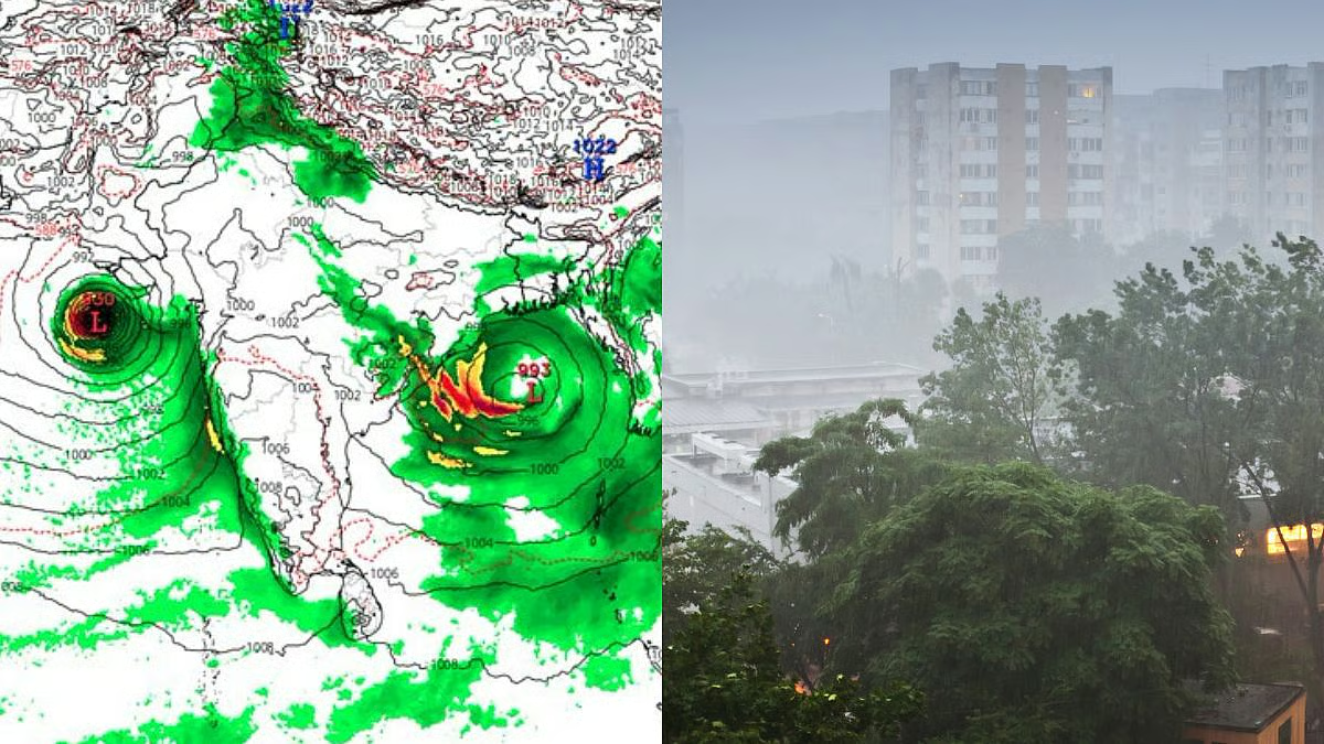
The weather system currently over the Bay of Bengal began as a low-pressure area south of the Indian coast. The IMD reports that the system was located [as of Oct 27] around latitude ~12° N and longitude ~85°–86° E, about 600-800 km off the east coast of India.
It is expected to intensify into a cyclonic storm and then a severe cyclonic storm by the time it nears the shore. The name “Montha” has been assigned once it intensifies past certain thresholds — as per IMD naming procedures for Indian Ocean storms.
Why does this matter? Because storms that strengthen over warm seas and move northwestwards towards the Indian coastline often carry the risk of heavy rainfall, flooding, coastal surge, and wind damage. Given the dense population and infrastructure along the east coast (Andhra, Tamil Nadu, Odisha), even moderate cyclones deserve serious attention.

Forecast Track & Timing
Here’s how the tracking and timing look based on the latest bulletins:
-
The IMD has said Cyclone Montha is likely to cross the coast between Machilipatnam and Kalingapatnam, near the Kakinada-area of Andhra Pradesh, during the evening or night of October 28.
-
The system is moving north-northwestwards at about 15 km/h (or similar) over the Bay of Bengal.
-
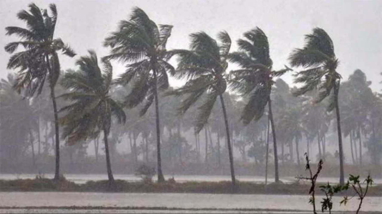
By the time of landfall, sustained wind speeds of around 90-100 km/h, gusting up to around 110 km/h, are expected in the most affected zone.
-
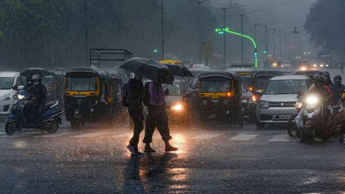
The rainfall and rough sea conditions will likely be felt a day or more before landfall — up to several coastal districts of Andhra, Tamil Nadu & Odisha will see heavy to very heavy rain until at least Tuesday.
In short: the system is not yet making landfall, but the preparation window is active now, and the states must assume the worst-case scenario to minimise damage and casualties.
Warning Levels and Affected Areas
Here’s a breakdown of the alerts and what regions are under watch.
Andhra Pradesh
-
Coastal districts such as Kakinada, Konaseema, West Godavari, Krishna, Guntur, Bapatla, SPSR Nellore are under red alert as the landfall zone.
-
The IMD bulletins flag “extremely heavy rainfall (≥21 cm in 24 h) at isolated places” in coastal Andhra and Yanam during 27-29 October.
Tamil Nadu
-
Several districts (Chennai, Tiruvallur, Kanchipuram, Ranipet, Villupuram, Chengalpattu, Puducherry region) are under orange alerts for heavy to very heavy rainfall.
-
The sea-near and low-lying zones of northern Tamil Nadu (close to Andhra border) may experience rough seas, strong winds and flooding.
Odisha
-
Southern coastal districts of Odisha (Ganjam, Gajapati, Rayagada, Koraput, Malkangiri) are under alert for rain and wind.
-
While the landfall is forecast in Andhra, peripheral impacts (rain, winds) will be felt in Odisha before/after the main event.
Impact Timeline
-
Until Tuesday (Oct 28): heavy rain and wind along the coast, especially Andhra + Tamil Nadu.
-
Post landfall – Oct 29 onwards: rainfall may shift inland, and flooding/overflow triggers in river basins and low-lying areas may appear.
Preparation & Government Response
Here’s what governments and agencies are doing to mitigate risk.

-
The Andhra Pradesh government has drawn up an action plan: stockpiling food, fuel, medicines; mobilising relief shelters; prepping for power outages and supply chain disruption.
-
Odisha has deployed disaster response teams (fire, rescue) across eight southern districts, initiated evacuations from vulnerable and low-lying areas.
-
Rail services in the region (Visakhapatnam–Chennai, others) have been cancelled or rescheduled, schools and colleges in vulnerable zones shut
-
The IMD and local meteorological agencies continue to issue bulletins; fishermen are advised to stay out of the sea for the next 24-48 hours.
These proactive measures aim to minimise casualties and damage, but the bulk of preparation rests on households, small businesses and local communities understanding the risk and acting accordingly.
Rainfall, Wind & Sea Conditions – Expected Impacts
Rainfall
-
Coastal Andhra and Yanam: “extremely heavy rainfall” (≥21 cm) at isolated places 27-29 Oct.
-
Tamil Nadu & Odisha: heavy to very heavy rainfall in specific districts up to Oct 28-29.
-
Rainfall may cause flooding in urban drain systems (especially Chennai), river catchments, and low-lying rural areas.
Wind & Sea
-
Winds of 90-100 km/h with gusts up to 110 km/h in landfall zone.
-
Sea conditions will be rough: high waves, storm surge risk, especially in coastal Andhra and Tamil Nadu. Boats and coastal operations should be suspended.
Secondary hazards
-
Urban flooding in cities like Chennai or the Andhra coast.
-
River bank overflow, especially in upstream catchments in Odisha and Andhra.
-
Landslides in hilly/forest regions of Odisha or Rayalaseema due to heavy rain.
-
Power cuts, uprooted trees, disrupted communications.
-
Supply chain disruptions: fuel, food, medical supplies in coastal zones.
What Should Residents / Travellers Do?
If you are in any of the affected states (Andhra Pradesh, Tamil Nadu, Odisha), or plan to travel there, here are key actions:

Before the storm
-
Monitor official bulletins from IMD and state authorities.
-
Keep emergency kits ready: torch, battery-power bank, bottled water, canned food, medicines, important documents in waterproof bag.
-
Secure loose objects (rooftop, balconies), clear drain gutters around home.
-
Shift vehicles away from trees/unstable structures.
-
Avoid fishing, coastal walks or boat operations until further notice.
-
If you live in low-lying area, prepare to evacuate; identify nearest relief shelter.
-
Keep mobile devices charged; note emergency helpline numbers.
During the storm
-
Stay indoors; avoid venturing out unless emergency.
-
Close windows and shutters; stay away from glass doors/windows if wind gusts.
-
Avoid sheltering under large trees or near power lines.
-
Do not wade through flood-waters—risk of hidden debris, open drains, or electric shock from downed lines.
-
If instructed to evacuate, do so quickly but in an organised manner.
After the storm
-
Report downed power lines or fallen trees to relevant authorities; do not attempt to fix or clear major damage yourself.
-
Avoid entering flooded structures until cleared by officials.
-
Be cautious about food & water contamination due to floodwaters.
-
Check your home for structural damage (roof, walls, foundation) before rehousing.
-
Help neighbours, especially elderly or physically challenged, if safe to do so.
Historical Context & Why This Matters
The east coast of India is no stranger to cyclones. States like Andhra Pradesh, Odisha and Tamil Nadu have experienced deadly storms in past decades. Each season reminds the authorities and the public of the importance of preparation, quick response and resilient infrastructure.
With climate change, the behaviour of such storms (intensity, rainfall amounts, inland penetration) may change. Therefore, even a “moderately severe” cyclone needs to be treated seriously. The fact that Cyclone Montha is the first significant system expected to make landfall this year gives added urgency.
It is not just the landfall point that matters — it is the broad rainfall footprint, surge and inland effects that often cause largest damage. For instance, a district in Odisha materially far from the coast may witness flooding due to heavy upstream rain. Hence, preparation cannot only be coastal.
Looking Ahead: What to Monitor
Here are some key things to watch in the coming days:
-
Official landfall time & location: While current forecast is evening of Oct 28 near Kakinada, track may shift.
-
Rainfall accumulations: Especially in vulnerable districts of Andhra, Tamil Nadu, Odisha. See whether “very heavy rainfall” conditions (100 mm+) appear.
-
Wind gusts & sea surge: How high the gusts become and whether sea surge leads to flooding in low lying zones.
-
Relief & evacuation numbers: How many people evacuated, how many relief shelters opened.
-
Infrastructure impact: Power outages, transport disruptions, road/bridge damage.
-
Post-storm analysis: Impact on agriculture (standing crops), coastal erosion, tree damage, urban flooding.
-
Institutional response: How quickly power is restored, how aid is distributed, how effectively the “zero casualty” goal is met by authorities.