

Polar Vortex vs El Niño: What to Expect This Winter
The polar vortex is weakening while El Niño continues to strengthen. Discover how these two major weather patterns could influence temperatures, snowfall and winter conditions in 2026–27.

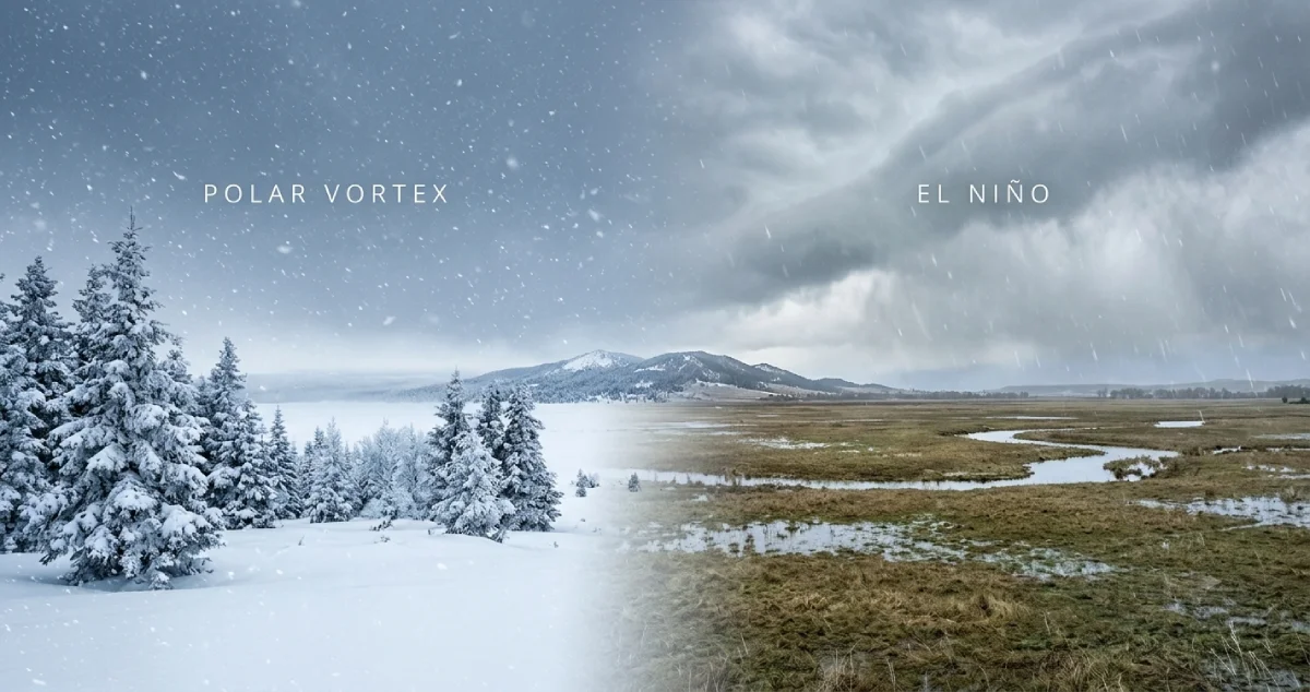
The polar vortex and El Niño are two weather patterns that are becoming the focus as winter nears. One is linked with the flow of very cold air from the Arctic and the other with the influence of temperature, precipitation and climate over various regions of the world.
The two will produce an interesting weather pattern this winter. The disturbance in the polar vortex is unusually early and is the topic of interest, while El Niño is still gaining strength.
So, what will this mean for winter 2026-27? Will there be freezing temperatures and heavier than normal snow in some locations and warmer than normal weather in others? Let's find out what's going on, and what people can expect.
What Do You Mean by the Polar Vortex?
A polar vortex is a large region of low pressure and high winds that forms around the polar regions of the earth during the colder months. It is found at high altitudes, especially in the stratosphere.
Imagine a circulation that spins around. It is usually helpful to retain extremely cold Arctic air close to the poles of the northern hemisphere.
If the polar vortex is deep and persistent, then cold air is likely to persist in colder areas. But a weakened, stretched or displaced atmosphere can cause a shift in the currents of the atmosphere.
This could help Arctic air to extend further south into North America, Europe and other areas. But if the polar vortex weakens, it doesn't mean that every country will see the cold weather or snowfall.
Explain El Niño and How It Impacts Winter
El Niño is a climate phenomenon that occurs when the sea surface temperatures in the central and eastern tropical Pacific Ocean are warmer than normal.
The warmer ocean temperatures affect the wind patterns, rainfall and circulation of the atmosphere. This phenomenon can, thus, influence the seasonal weather patterns thousands of kilometres away, which is why El Niño impacts seasonal weather.
It has varying effects in different parts of the region. There is a possibility of warmer and drier conditions in some regions and more rain and/or altered storm patterns in other regions.
The US National Oceanic and Atmospheric Administration (NOAA) reported that El Niño started to intensify during November 2026. The Weather Channel's Climate Prediction Center forecasted a strong to very strong event was in the forecast for January–March 2027. But the actual weather effects are not guaranteed.
What's the Difference Between Polar Vortex and El Niño?
While both have an effect on winter weather, they do so in different ways.
| Feature | Polar Vortex | El Niño |
|---|---|---|
| What it is | A large-scale wind circulation around the poles | Warm pattern in the tropical Pacific Ocean |
| Main location | In the high latitudes above the Arctic and Antarctic areas | In the central and eastern tropical Pacific |
| Main influence | Can affect the movement of cold Arctic air | Affects the world's temperature, precipitation and weather systems |
| Winter connection | A weakening could lead to a higher risk of cold air outbreaks | Can alter seasonal variations in temperature and precipitation |
| Predictability | It is stronger and in a different location throughout the year | The temperature of the ocean can be used to track its development |
These are not two opposite forces pitted against one another. They are sections of a much larger system of the atmosphere.
So, Why Is the Polar Vortex in the News in November 2026?
The polar vortex has been getting attention due to an oddly early-time disturbance.
The Stratospheric Polar Vortex (SPV) was already being disturbed in early November, and there were indications of Sudden Stratospheric Warming (SSW), notes the UK Met Office. This happens when the temperature in the stratosphere increases quickly and the powerful winds around the polar vortex wane. During large-scale events, these winds may even change direction.
Interestingly, the disturbance is occurring at a time of year which is much earlier than the abrupt stratospheric warming events which meteorologists normally watch in midwinter.
Weather forecasts are pointing to the possibility of this disruption impacting the weather for the next few weeks. Researchers continue to watch its impact on the lower atmosphere.
What Is the Remote Connection Between a Weak Polar Vortex and Extreme Cold?
The troposphere is the lowest layer of the atmosphere, where most of the day-to-day weather occurs. The polar vortex forms at higher altitudes, but weather variations in the stratosphere may sometimes affect the weather nearer to the ground.
As the vortex weakens, it can impact the jet stream, a swift stream of air that can influence weather patterns.
This can lead to the development of blocking conditions in the atmosphere that can allow the cold air to penetrate deeper south and stay there for a longer period of time.
Under certain circumstances, this leads to:
-
Rapidly changing weather.
-
Cold waves experienced in parts of North America and Europe.
-
Increased chances of frost and freezing conditions.
-
Snowfall in areas where moisture and suitable temperatures come together.
But a disruption of the polar vortex doesn't mean a snowstorm. The result is influenced by a variety of atmospheric factors such as the jet stream, moisture and local temperatures.
What's the Connection Between El Niño and the Polar Vortex This Winter?
It's from there that it gets interesting.
El Niño has a wider impact than temperature changes in the oceans. It can also alter the large-scale circulation of the atmosphere and the waves passing through the atmosphere.
During El Niño, the stronger thunderstorm activity over the central Pacific can impact the atmospheric waves, according to the Met Office. These waves can move up and upset the stratospheric polar vortex.
This increases the potential for some polar vortex disturbances in a given year, but doesn't necessarily mean that will happen.
The two patterns can thus affect each other indirectly. They can have combined effects that can lead to complex winter weather situations and make seasonal forecasting more challenging.
What to Expect During Winter 2026–27
The winter forecast is not as simple as saying that the world will experience an unusually cold or warm season. Different regions may experience different conditions.
1. North America
Parts of the United States and Canada could experience periods of colder weather if polar vortex disruptions help establish favourable atmospheric patterns. At the same time, El Niño may encourage warmer seasonal conditions in some northern areas.
2. Europe
The polar vortex disturbance could influence the jet stream and increase the possibility of colder spells in parts of Europe. However, the location of high-pressure systems will play an important role in determining whether a region experiences cold, dry or unsettled weather.
3. Asia and India
El Niño can influence weather patterns across Asia, including rainfall and temperature conditions. However, its effects vary by season and location. The polar vortex does not mean that India will automatically experience an extreme cold wave.
For India, local winter forecasts, western disturbances and regional atmospheric conditions remain important when assessing cold spells, fog and snowfall.
Does a Weak Polar Vortex Mean a Colder Winter?
Not necessarily.
One of the biggest misunderstandings about the polar vortex is that its weakening always brings extreme winter conditions.
A sudden stratospheric warming event can increase the chances of colder weather in certain regions, but its effects may take weeks to reach the lower atmosphere. Sometimes, the influence is weak or does not produce a noticeable cold spell in a particular location.
The Met Office also explains that even a major sudden stratospheric warming does not automatically mean snow or severe cold for the UK.
This is why meteorologists monitor several indicators instead of relying on one weather event to predict an entire season.
Final Thoughts: Which Weather Pattern Will Shape Winter 2026–27?
The polar vortex and El Niño are both important factors in understanding the upcoming winter. El Niño is strengthening and could influence seasonal weather across several regions, while the unusual polar vortex disturbance has introduced another layer of uncertainty.
The coming months may bring a mix of warmer conditions, cold spells, rainfall changes and snowfall, depending on the region.
Rather than expecting one global winter pattern, it is better to follow updated forecasts from official weather agencies. As more atmospheric data becomes available, meteorologists will get a clearer picture of how these two major weather patterns could shape winter 2026–27.











Comments (0)